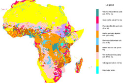
13 January 2009: The International Center for Tropical Agriculture (CIAT), a research center of the Consultative Group on International Agricultural Research (CGIAR), will produce a detailed digital soil map of 42 sub-Saharan countries. The project, named the African Soil Information Service (AfSIS), will provide information necessary to overcome soil depletion and improve crop production through better soil management.
Nteranya Sanginga, Director of CIAT’s Tropical Soil Biology and Fertility Institute, which will lead the project, stressed the need to improve soil management in sub-Saharan Africa to reduce poverty, feed growing populations and cope with the impact of climate change on agriculture.
AfSIS is supported through a four-year grant of US$18 million from the Bill & Melinda Gates Foundation and the Alliance for a Green Revolution in Africa. The project will use innovative technologies such as remote sensing via satellite and infrared spectroscopy to analyze the chemical and physical properties and organic matter of soil samples. This information will be made available via the Internet and ultimately will become part of a global soil mapping initiative called GlobalSoilMap.net. [CIAT Press Release] [AfSIS Website]
CGIAR’s CIAT to Create Digital Map of Africa’s Depleted Soils to Enhance Food Production and Cope with Climate Change
story highlights
3 SDGs
No Poverty
Partnerships f...
Zero Hunger
3 SDGs
No Poverty
Partnerships f...
Zero Hunger